 HammBurg Be informed with latest news, reviews, entertainment, lifestyle tips, and much more.

Geoscience is the study of our planet: atmosphere, oceans, ice, soil, and the Earth’s complex surface. It covers the aspect of people coexisting with the Earth’s nature. To study all this, scientists utilize geospatial technologies that are ultimately the modern tools that help with geographic mapping and analysis of the Earth and people interaction.
Currently, there are different types of geospatial technologies, but remote sensing seems to be the most used of them. And the main instruments of remote sensing technology are satellites that offer unmatched amounts of valuable information on the Earth’s surface and its changes over time. With the development of software and datasets, the collection, storage, and analysis of this spatial and geographic data have reached new heights. You can learn about it by taking a course online and get Online certificate in GIS.
The number of industries deploying remote sensing technology keeps growing, offering faster and more reliable decision-making in issues concerning biodiversity preservation, forest fires monitoring, industrial engineering, crop management, and much more. Let’s see how this works before we move to the ways GIS is used in different science.
The Importance of Vegetation Indices
Vegetation monitoring plays a huge part in helping to detect and solve food crisis issues at both local and global scales. But the use of vegetation indices goes far beyond vegetation monitoring. They are applied in drought studies, farming management, climate and hydrologic modeling, forest fires management, etc.
So what is a vegetation index? Ultimately, it’s a value that indicates vegetation structure and health and is calculated based on light reflection and absorption across bands, relying on the fact that healthy vegetation reflects light strongly in the near-infrared band.
That is how the most frequently used vegetation index NDVI (Normalized Difference Vegetation Index) is measured. It basically calculates the visible and near-infrared light the vegetation reflects. If the vegetation cover is healthy, it will absorb most of the visible light, reflecting the near-infrared light. Vice versa if the vegetation cover is unhealthy.
Speaking of such a huge issue as forest fires monitoring, one of the methods of remote assessment of burned areas and the degree of damage done to the vegetation cover after a fire is using the indexes obtained from the processing of images made at different times. The most frequently used index for this purpose would be the NBR (Normalized Burn Ratio). It’s calculated similar to NDVI with the only difference that it uses near-infrared and shortwave-infrared portions of the electromagnetic spectrum.
Apart from vegetation monitoring, GIS technology is utilized by different sciences for a variety of purposes.
GIS in Forecasting
Meteorologists can utilize remote sensing technology to easily detect changing climate and weather patterns, creating more precise and accurate predictions.
The use of satellite data in climate change monitoring is hard to overestimate. Some examples of what it can be used for include:
- Sea level change monitoring
- Vegetation change monitoring in particular areas
- Sea ice and glaciers monitoring
And of course, precise weather forecasts are critical in agriculture, especially when growing crops that are vulnerable to weather changes.
GIS in Geology
Satellite monitoring enables geologists to collect precise information on the land’s structure from all over the world simultaneously and remotely. Mapping and further analysis of this data is the main reason for using remote sensing in geology.
What is more, satellite data is especially valuable in the mining industry, since it enables effective prospecting in mineral exploration, allowing to operate efficiently and make accurate decisions on the place of drilling. It’s also important for ensuring safety standards maintenance and preserving the environment when it comes to mining.
GIS in Environmental Studies
Remote sensing is also widely used by professionals that research environmental systems and their functioning with the aim of finding new solutions to tackle any threats. This includes:
- Species habitats monitoring
- Different types of pollution and its effect detection
- Places of resources depletion detection
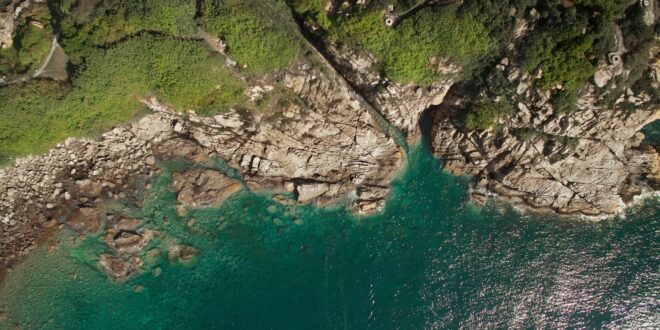
GIS in Oceanology
The implementation of remote sensing in oceanography is about giving scientists a much broader perspective on the underwater world, including the seafloor, coastal regions, depth values, water surface temperature, waves heights, and more. This data can be used not only by researchers but also by different organizations to help them detect any threats along the coastline and guide water transport through the safest places.
Overall, remote sensing plays a key role in geoscientific research with a vast range of satellite data applications. Scientists use it to retrieve, visualize, and analyze Earth data with the aim to uncover new important insights about our planet.